
- Questo evento è passato.
9 – 10 – 11 – 12 – 13 Agosto 2017 Tour de “La Bessanèse”
9 – 10 – 11 – 12 – 13 Agosto 2017 Tour de “La Bessanèse”
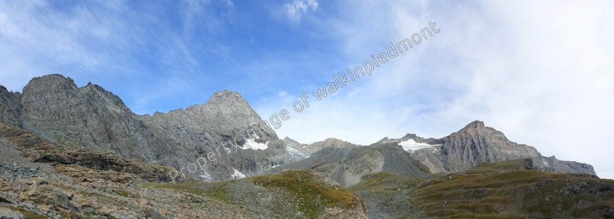
Situato nel Piemonte nord-occidentale, il Tour de “La Bessanese” è un percorso in ambiente di alta montagna tra Italia e Francia, intorno al gruppo montuoso dell’Uja Bessanese (3604 m); il tour si sviluppa su un percorso di antichi sentieri utilizzati sin dall’epoca romana, su sentieri tracciati e tracce su terreno morenico. Il punto più alto del percorso raggiunge i 3200 mt. del Passo del Collerin. Il tracciato, di circa 32 km ed un dislivello totale di circa 2600 mt., è suddiviso in cinque tappe con soste in confortevoli rifugi alpini. Il percorso non presenta difficoltà alpinistiche, ma per l’ambiente severo in cui si svolge anche per eventuali condizioni climatiche non ottimali, richiede una certa esperienza, un’attrezzatura adeguata alle condizioni del percorso ed un buon allenamento / preparazione. Lungo il tracciato sono posizionati i tre rifugi che garantiscono ricovero e ristoro agli escursionisti: il Rifugio Cibrario e Rifugio Gastaldi in territorio italiano ed Refuge d’Averole in Francia.
Il primo giorno e l’ultimo giorno sono dedicati all’arrivo e partenza in valle, con soggiorno in strutture, viaggio da e per Aeroporto Caselle/Stazioni Trenitalia a Torino, eventuali brevi visite di siti di interesse storico-architettonico-culturale nell’area.
Visitate il sito www.walkinpiedmont.com
Scrivete a info@walkinpiedmont.com o chiamate il +393337910101 per avere informazioni, date costi e dettagli.
Located in the northwestern Piedmont, the “Bessanese Tour” is a path in high mountain environment between Italy and France, around the mountain group of Uja Bessanese (3604 m); the tour is on a path of ancient trails used since Roman times, on paths and tracks on moraine. The highest point of the trail reaches 3200 meters of “Passo del Collerin”.
The route of about 32 km and a total elevation gain of about 2600 mt., Is divided into three / four days with stops in comfortable mountain huts.
The route does not present climbing difficulties, but for the harsh environment in which it also plays for the weather conditions are not optimal, requires some experience, proper equipment to route conditions and good training / preparation.
Along the route of the three shelters they are placed that provide shelter and refreshment to hikers: Refuge Cibrario and Rifugio Gastaldi in Italian territory, and Refuge d’Averole in France.
The first day and the last day are dedicated to arrival and departure in the valley, with stay in facilities, trip to and from Caselle / Stazioni Trenitalia Airport in Turin, possible short visits of sites of historical-architectural-cultural interest in the area .
Visit www.walkinpiedmont.com
Write to info@walkinpiedmont.com or call +393337910101 for information, cost dates, and details.
Visit www.walkinpiedmont.com
write to info@walkinpiedmont.com or call +393337910101
for information, costs, dates and details